Agriculture
Spray or spread when the crop needs it, not when the ground allows it.
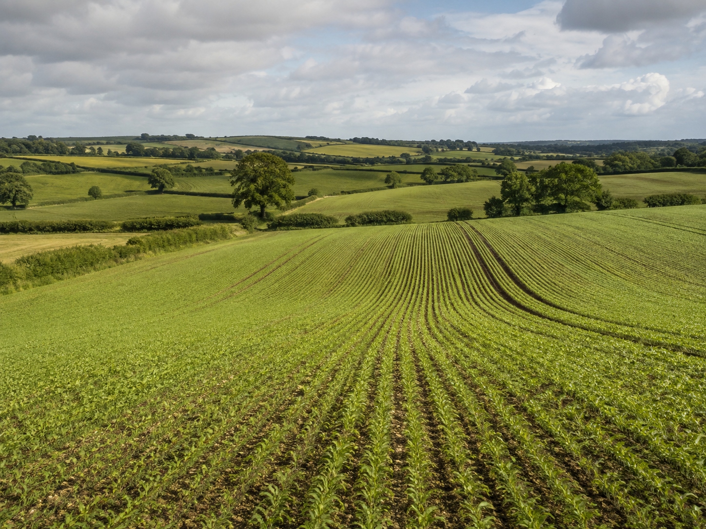
Spray, seed and map arable and mixed farms by drone — keeping the crop programme on track when wet ground, tall crops or tight windows stop conventional machinery. We operate above the crop, so applications stay timely and fields stay intact.
- Application platform
- FP700 / DJI Mavic Multispectral
- Compliant operations
- CAA
What we do
Targeted management without the ground impact.
- Foliar nitrogen, manganese and fertiliser application by drone
- Cover crop, companion crop and grass seeding into standing crops
- Pod-Stik and pre-harvest protection for OSR, beans and pod crops
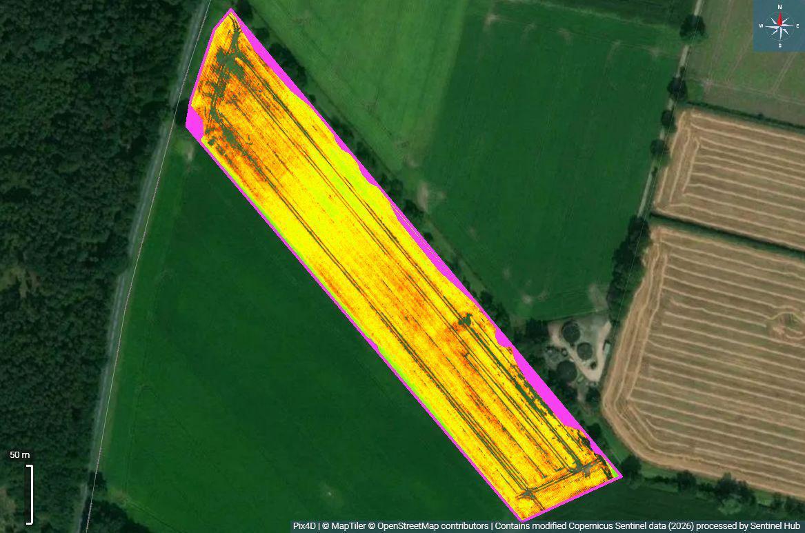
- Multispectral NDVI mapping and crop vigour analysis
- Five-zone management maps and variable-rate application (VRA) files
- Application above tall crops and wet ground without compaction or ruts
- As-applied records, flight logs and geo-referenced maps for every job
What's the benefit
- Apply when the ground won't carry a sprayer — no waiting for dry weather
- No soil compaction, ruts or tramline damage from heavy machinery
- Targeted rates per management zone, not broad field averages
- Timely passes at the growth stage that actually protects yield
- Whole-field coverage with dated, geo-referenced application records
What you gain
Deliverables agreed before we fly.
- 01
Product applied to your own specification and timing
- 02
Broadcast seeding into standing crop: cover, companion, grass or stewardship mixes
- 03
High-resolution orthomosaic of each field in GeoTIFF format
- 04
NDVI crop vigour map showing variation across the field
- 05
5-zone management map with area per zone and a VRA rate map
- 06
As-applied record with date, area, rate, product and flight log
Example application: crop intelligence
The field looks even. The crop is not.
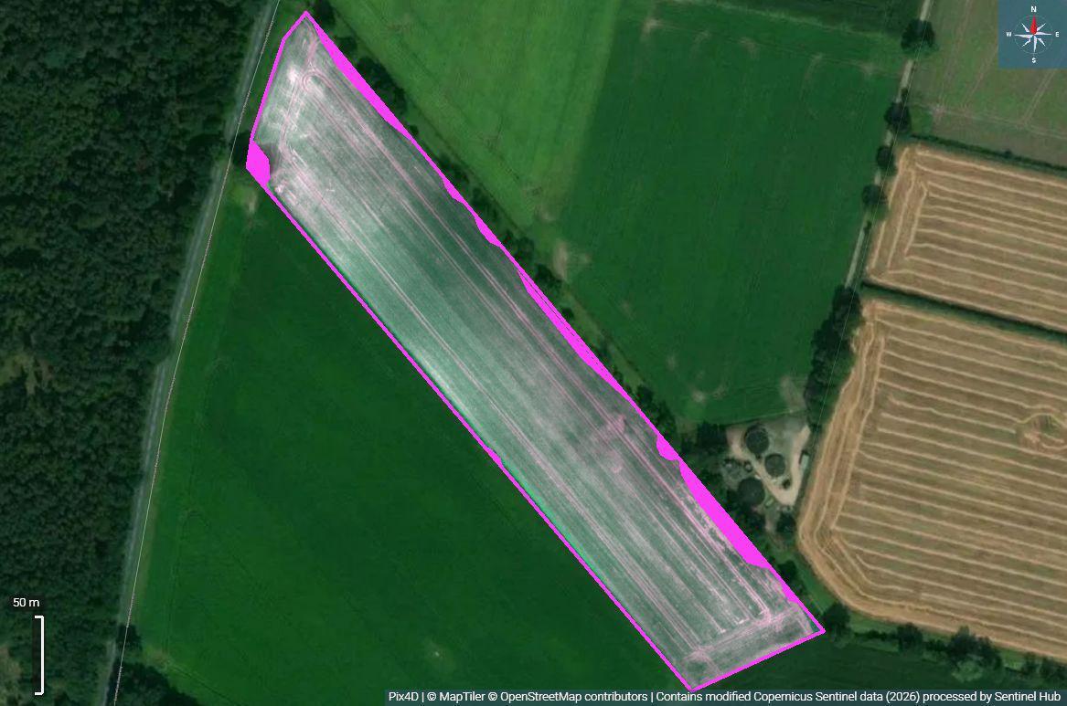
On the left, the orthomosaic: one crop, one colour, one flat rate. On the right, the NDVI layer over exactly the same ground. The variation was always there — it was just invisible from the cab.
Drag the handle, or use the slider beneath the image.
 OrthomosaicNDVI
The full chain
Four layers, one field, one application plan.
A true-colour base map of the field
Individual drone images are stitched and georeferenced into a single orthomosaic. The mapped boundary defines the exact treatable area, so plans, volumes and invoices all work off the same figure.
What it tells you
- Field boundary and treatable area
- Tramlines, headlands and access
- Visible establishment and gap patterns
NDVI legend
From our own operations
Fly the mission, process the data, act with precision
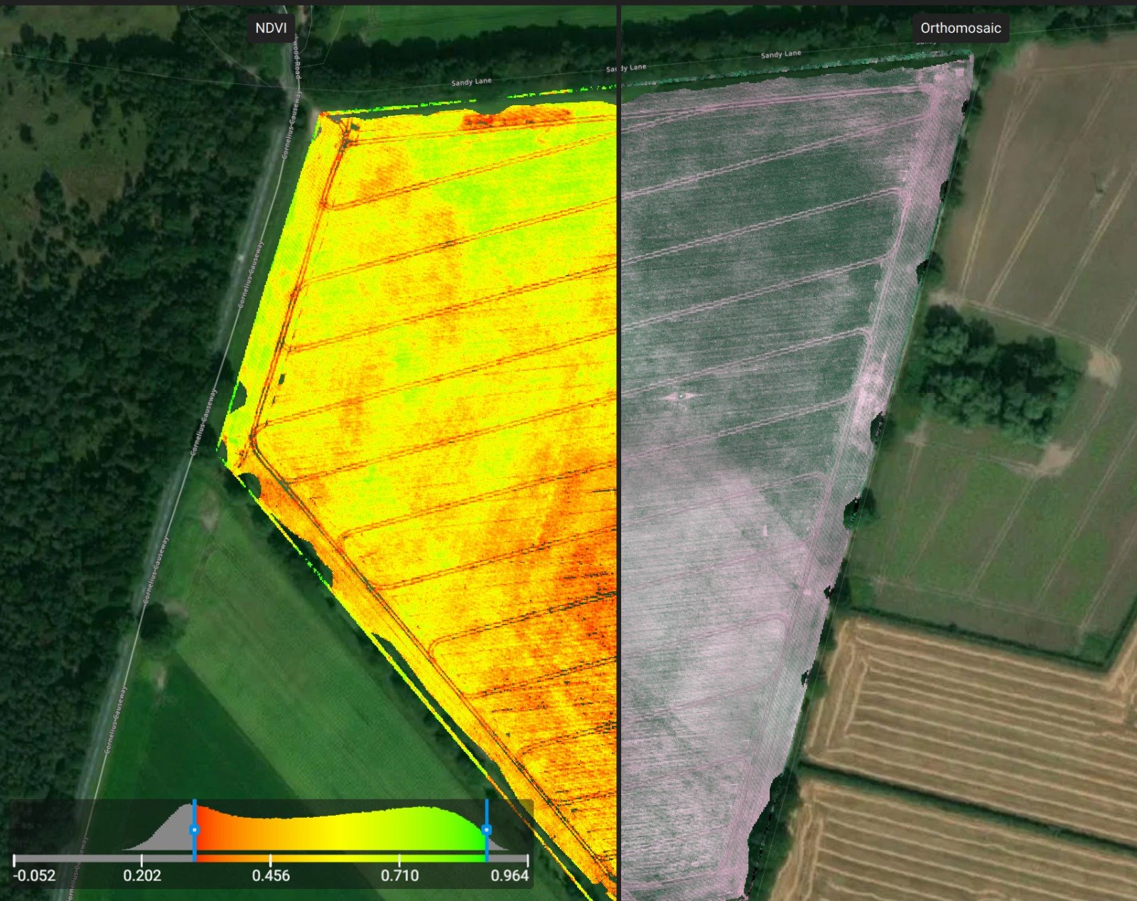
NDVI - Orthomosaic image
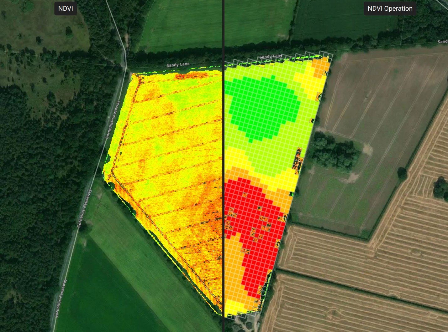
NDVI - VRA operation
Applications
Products we apply in agriculture.
Book a free Field Ingenuity assessment
Farm, woodland, solar site, nursery or sports turf — tell us the ground, the objective and the window you need to hit. We will tell you honestly whether drone application, mapping or both are the right answer, and what it would deliver.